Friday, December 21, 2007

PART V: Heading Home


We took a less treacherous route on the drive home, but no less beautiful. Here are some pics of the awesome roads, mountain vistas, and cloud covers...


PART IV: Dirt-Biking Off Erosion Road


Next, the three of us (yes, Lola included) went dirt-biking on some trails around the desert. First, we went to Desert Gardens, which wasn't very impressive - it looked just like every other part of the desert. Then, we took the S-22 out through the Badlands and took a four-mile desert trail out to Font's Point. One of the locals referred to it as "The Edge of the World" and I thought that was the perfect analogy.


On our way to Desert Gardens


Ben takes a spin across the creek


Lola was happy to see Ben return for us!


Ben and Mule at Font's Point


A view from Font's Point (The Edge of the World!)


Me & Ben


Mule parked at Font's Point (Try to imagine if we didn't have airplanes to get us around the country!)


Another shot of Mule


PART III: Palm Canyon Trail and the Oasis


Ben and I hiked from our campsite down the Palm Canyon Trail to find an oasis. The trail is a three-mile round trip hike through the desert. Ben and I took the somewhat more ambiguous and circuitous "Alternate Trail" so I'm not exactly sure how long it was but I know it wasn't as clearly marked as the trail they advertised in our trail guide. However, we DID find the oasis and it was pretty amazing. This is where people usually spot Bighorn Sheep drinking along the waters edge. Unfortunately, we didn't spot any on our hike. My only regret was not bringing more water on the hike because the sound of running water in the hot desert sure does make me thirsty. Luckily, it was mostly a downhill hike to get back to Tater and fresh, cold drinking water!


Setting off on the Palm Canyon Alternate Trail


A view towards our campsite


Me and an ocotillo


A cool cactus


The oasis


Bridge over untroubled waters


Ben at the oasis


I still can't believe we found running water in the desert!


A view of the oasis looking back from whence we came


The palm grove

PART II: Arriving at Anza Borrego Desert SP


Once we arrived at Anza Borrego Desert State Park, we checked out the Visitor's Center and picked out our campsite. We took in all the sites and then checked out the town of Borrego Springs (population around 2900). Long straight roads make up most of the town (I'm talking maybe THREE long straight roads!) We talked to some of the locals and had some drinks at the local watering hole.


Some facts about Anza Borrego Desert State Park:


  • Anza Borrego Desert State Park is the largest state park in California

  • The temperature in the summer can get as hot as 120 degrees! (and people STILL live there?)

  • It is named after Spanish explorer Juan Bautista de Anza and borrego, the spanish word for Bighorn Sheep (unfortunately we didn't spot any during our visit)

  • The area is covered in Ocotillo - tall, spindly plants that grow red flowers on the tips.


Me at the Visitor's Center


Ben with Tater and Mule at the Campsite


Tater and Mule at the Campsite


Ben and Lola setting off on a hike up the Mountain


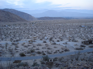
Lola on the Mountain (Tater is the white spot down below)


Another View of Tater and the Desert from the Mountain


More Desert (Ben climbed up pretty high to get this shot...Tater is the white dot in the lower left)


Lola LOVED the desert... (except when the cactus stuck her in the nose)

PART I: The Drive to Anza Borrego Desert State Park


Earlier this week, Tater and the pack went camping in Anza Borrego Desert State Park, in eastern San Diego County. Due to the large volume of photos, I am posting them in 5 Parts. The photos you see here were taken on the drive to the desert... We took the scenic Routes 78, 79, and S-22, winding up and down the mountains. The road was treacherous at times, but Tater handled it well. The photo of Tater was taken from a lookout point on the S-22, where on a clear day you can see across the desert all the way to the Salton Sea.


Saturday, December 8, 2007

Raindrops Keep Falling on my Tater

One of my favorite things about living in an RV is the sound of rain falling on the rooftop. Luckily for me, winter is the rainy season here in San Diego and it has been raining off and on for two days!! When I lived in an apartment and drove a car, rainy weather was never something I looked forward to. Interesting how my opinion has changed. Lola, on the other hand, continues to loathe her raincoat. (Actually, she only has to wear that when I make her pose for pics ;)

Lake Murray

About a week ago, we spent the day at Lake Murray... just east of San Diego. Here are some pics...


Tater Has New Cargo

Ben attached a motorcycle rack to the back of Tater...